I think this is still a pretty early beta too.
i couldnt get las vegas to work for any birds eye shots
Mine definitely has my house without any car in the driveway… and theres 6 cars at this household so thats like a one-time kind of thing. I think the Google one is better, but whatever.
yea i know … my driveway has me home alone … but it looks like my brother is sitting at the stop sign at the end of the street,lol
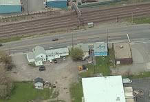
The zoomed images are not from satellites as JayS posted earlier. Thats why the N, E, S & W images aren’t exactly from the same time period. The pictures are taken from low flying planes with digital cameras–> http://www.pictometry.com/
It would be something though if they could do this with satellites.
this was years ago
holy weird
The satellites we access to can’t, but the ones the government has can get a whole lot more detail than these images.
Thats cool. They have a lot of land to cover to get that much imagery. but cool either way.