Just a heads up the roads a real bad out there around here. Tonawanda, NT, Kenmore, and Amherst area. Saw three accidents on the way to my house on break here. I will post up some shitty camera phone pics in a sec.
 i’m headed to walden area in a few hours.
its dumping in west seneca, but my gf’s mom says there is nothing in lockport.
About time I’m going out for a drive, not much more than an inch at the galleria area where I’m at.
im at main and transit and not much to report here. maybe an inch
yah! keep me posted!
Just looked down @ at the street. Pretty shitty conditions. If you have shit you need to do get it done now kids. And fuck me i only have a quarter tank of gas.
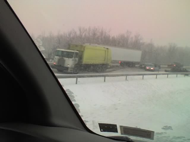
290^
290^
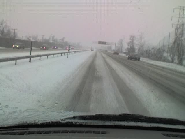
Niagra Falls Blvd @ Willowridge.^
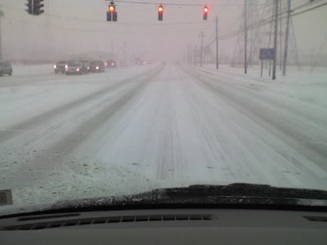
Niagra Falls Blvd. near Ellicott Creek.
LAKE EFFECT SNOW ADVISORY IN EFFECT FROM 1 PM THIS AFTERNOON TO 7 PM EST THIS EVENING
UNTIL 12:45PM EST
Urgent - Winter Weather Message National Weather Service Buffalo NY 445 AM EST Tue Jan 23 2007Northern Erie- Including The City Of… Buffalo
… Lake Effect Snow Advisory In Effect From 1 PM This Afternoon To 7 PM EST This Evening…
The National Weather Service In Buffalo Has Issued A Lake Effect Snow Advisory… Which Is In Effect From 1 PM This Afternoon To 7 PM EST This Evening.
Disorganized Lake Snows Over The Southern Part Of The County Will Drift North And Become Better Organized By Early Afternoon. A Well Developed Band Of Lake Snow Is Then Expected Across The Northern Half Of The County During The Afternoon And Evening.
Snowfall Rates Of An Inch An Hour Will Likely Produce 3 To 4 Inches Of Accumulation This Afternoon… With Another 1 To 3 Inches Possible This Evening Before The Band Shifts Back To The South.
Since The Bulk Of The Snow Will Fall During And Just Prior To The Late Afternoon Rush Hour… Commuters Should Plan Accordingly.
In Lake Effect Snow The Weather Can Vary From Locally Heavy Snow In Narrow Bands To Clear Skies Just A Few Miles Away. If You Will Be Traveling Across The Region Be Prepared For Rapid Changes In Road And Visibility Conditions. Stay Tuned To Noaa Weather Radio And Other Radio And Tv Stations For Further Details Or Updates.
It was a whiteout here at millersport & n.forest, but about 2 minutes ago it just stopped. Must be the lake effect band shifted.
wow, didnt expect to wake up to this. good thing it only takes me 10 mins to get to campus
If this keeps up till 7 its gonna be one kick ass storm.
This winter most of the storms seem to bitch out before they become anything good.
Think it will hit Roch area?
^^ one can only hope
Snow is good. Went out on Sunday snowmobiling out at Sprague Brook, with barely enough to ride. Gonna be some good ridin’ very, very soon 
Mmmmm was a whiteout a few ago, now its meeked out and its barely coming. Either way I’m feeling a 2nd meet up tonight!