Done
on Ontario ![]()
But I’ll be heading up the Trent-Severn this Summer, so I’ll definitely be in Ontario for a little while. Not sure if I’m going to go the full length to the Georgian Bay though. It’s a bit of a trek.
I’m staying on Gloucester Pool for a week over the summer and stumbled on this today:

You should probably do it ![]()
The Big Chute Marine Railway is the ONLY one of its kind in North America still in use. Officially known as Lock 44 of the Trent-Severn Waterway, it works on an inclined plane to carry up to 100 foot boats up (or down) the 60 foot change in elevation.
http://www.pc.gc.ca/en/lhn-nhs/on/trentsevern/visit/services/ecluse-lock-44-big-chute
LOL. Yep. Doing the lift locks in Peterborough, and going to try to get to the end. Apparently that thing can handle more than my joint weighs, so yay for that.
I kinda want to ride it with my ski just for how ridiculous it would look, lol.
Keep me posted on when you’re going to be up there. Would be an odd NYSpeed watercraft rendezvous. I’m thinking mid-July for the trip, but not set in stone.
Mid August here. I’ll have a dock but I’m not sure of the depth.
And who knows, it may be that late for me too. No worries about the dock, I can always stay out on the hook. Still looking for a decent tender though.
Still, before that, maybe another Lake Ontario GTG. I can throw a slightly larger wake for y’all ![]()
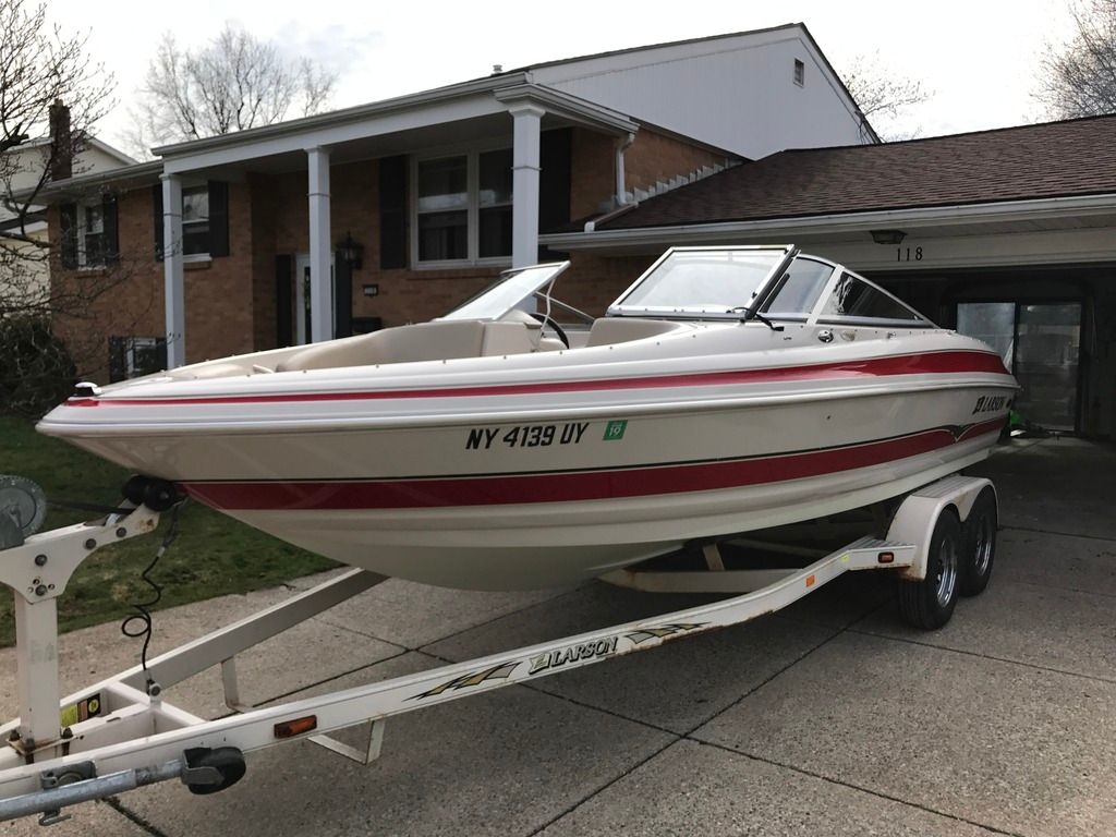
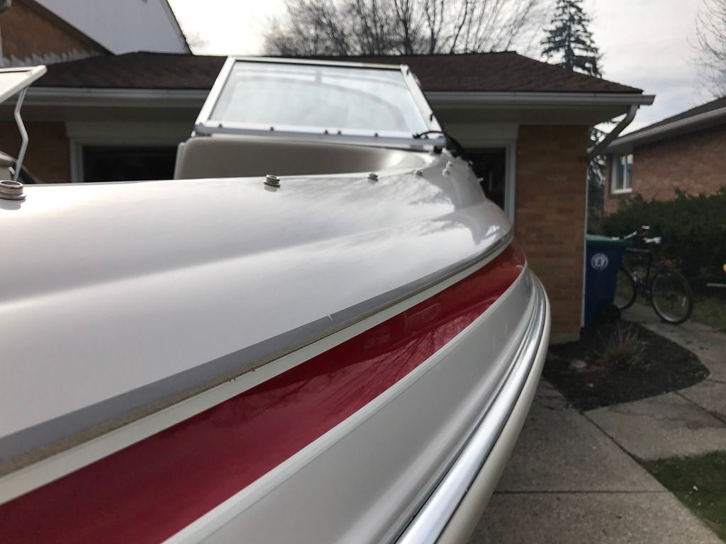
Put in a whole lot of time with the high speed rotary buffer and some rubbing compound, polishing compound and wax. Brought the gelcoat back to like new.

Looks good :tup:
I’ve seen quite a few boats out already, as well as one ski. almost that time :tup:
The Lake Ontario water level is nuts.
I launched my little boat a few weeks ago so I could check the shoreline and see if we had any impending flooding issues. I figured that it would need to come up about another 18 inches before I really need to worry. The water is up over a foot since then.
My onshore dock in Sodus Bay is just about under water. I’m going to take a run out to the island tonight make sure that my shed isn’t flooded, and adjust my dock lines.
I was out Saturday on the upper Niagara and I’ve never seen so much debris floating down river. It was a constant slalom.
And farther below Lake Ontario
Takes in what Lake Erie can send her
Lovethatsong.
Yeah, my shoreline is littered with debris, there’s shit floating all throughout the bay. Going out this weekend to sandbag and start cleaning up.
On the plus side, I scored 4 6x6x8 PT timbers… so I’ve got that going for me, which is nice.

@superfan99 Curious on your take on the Plan 2014 stuff. I know a lot of waterfront people are blaming it but from what I’ve seen it only would have been an inch or two difference under the old plan and the biggest contributor is the fact that we had a lot of snow melt and the wettest April since the 50’s. As someone who doesn’t really trust the government, doubly so when you get a plan that involves the governments of two countries, I was curious if you heard any counter point to the Plan 2014 claims that it isn’t their fault?
I’m in favor of Plan 2014, but I’m a hippie and purchased a cottage that’s about 20 feet above the 100 year flood data. There were other homes available with fewer stairs and closer to the water, but honestly the potential for flooding was a part of our decision. The lake water levels weren’t regulated until 1958 when the original plan was enacted and Moses Saunders was built. Water levels went a lot higher and lower before it was regulated. It varies across the Ontario shoreline, but a number of homes being flooded now have flooded in the past (and have flooded since plan 1958 was enacted).
IIRC the current water levels have been exceeded twice since the 70’s, and maybe 4 or 5 times since the original plan went into effect in the 50’s. In essence, all of the property currently being affected by the current water levels have been subjected to this before, so imo they’ve had fair warning. Back in the 70’s half the homes on Charles point and Knob Island on Sodus Bay were washed off their foundations by a storm the last time water levels were this high. It’s honestly all part of the risk of owning property in that area.
Based on the available data, it doesn’t appear that water levels would have been much different under the previous plan. What I think is being ignored by a lot of people saying that the previous plan would have released water sooner, is that under the previous plan they also would have stopped the outflow sooner because of a requirement to “recapture” outflows.
Plan 2014 does allow for greater variability in water levels, but it also doesn’t have the recapture requirements. Some idiot on the news the other night was talking about how levels were falling in the upper great lakes and thought that meant they should be falling in Ontario, completely ignoring that Ontario is the end of the line and the water from the upper great lakes eventually empties into Ontario. They also have a lot of flooding along the St Lawrence and into Montreal from what I understand, another reason they haven’t significantly increased outflows.
On a personal note, my shoreline is flooded, but the wave action has driven more sediment and gravel onto my shoreline(looks to be between 2-6 inches of new material). When water levels drop, I’m going to have a bigger beach. To that end, plan 2014 is doing exactly what they suggested it would. In other places it’s scouring the shoreline, some people will have a positive effects, others will have negatives.
^ Good info.